GPS/ GIS Mapping Tools
Tools to use on the internet
World Mapperhttp://www.worldmapper.org/
Look at the population map Land area Children Elderly Tourism Food Wealth Poverty Earth Cache
|
National Atlashttp://nationalatlas.gov/
They took all the USGS maps and digitized them and you can download them for no cost. You can follow them on twitter. Can make your own maps. Create templets and blackline masters. esri Express Yourself with MapsUtah AGRCgis.utah.gov/data/boundaries/citycountrystate
PC computers: First Download Data Package In a shape file Learn to take Arc map and then SDE Do it as a district...and put up for teachers WHY we need GIS mentors.. Educator Self-CheckTime devoted to project?
Time to call community partners? Technology? Software to complete project? Skills of students? Ed tech can help us Community need? Backward DesignWhat data do I want to collect?
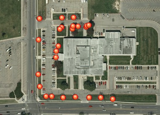
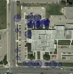
What need? What evidence to I need to collect? Plan the learning experience. What do you really want them to remember? They can fix a problem when you have information. Teach: how to learn a tool...writing...collaborating as a team Worth being familiar with...problems of the world Assessment: Open ended and authentic results..why rubric? rubric that is about insight and meaning Hook- hold their interest Equip- experience it..and listen to their feedback Rethink and revise Project mostly: THe needs of the community Tree mapping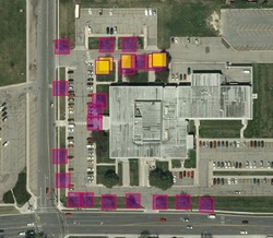
Conifer and Deciduous...yellow is conifer and purple is deciduous
Tree height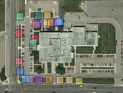
The trees come in a variety of heights.
Tree Condition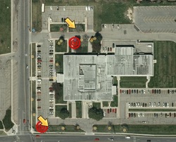
The yellow arrows are my favorite trees. The red circles have wonderful canopies.
|
A to Z Maps OnlineMap siteGuest SpeakersKevin- Nick Kryger- amazing lecture..showing water, sewer...light..amount of daylight on houses/gardens Cindy Clark [email protected] Call anytime if you have questions 801-537-9201 The state of Utah Automated Geographic Reference Center- she works GIS day event in November -How to bring it into High School/Middle Secondary...will bring a mentor into the class http://GIS.utah.gov has data (over 400 data sets to find), developer(base maps there) stuff, tweet,or blog...News..what is going on in the state..what we are developing. connecting with data: http://gis.utah.gov/data/connecting-sgid-arcsde-server/ Take off this put it into shape files and bring it back in. Connect to the Imagery: http://gis.utah.gov/data/utah-sgid-image-server/ NEW BASEMAPS http://mapserv.utah.gov/argis/rest/services Has vector, hillshades, etc UEN classes available http://www.uensd.org/gis/ School info: www. esri.com/industries/k-12 November 27 and 28, 2012 Summer Class Schedule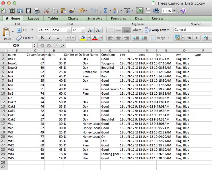
|
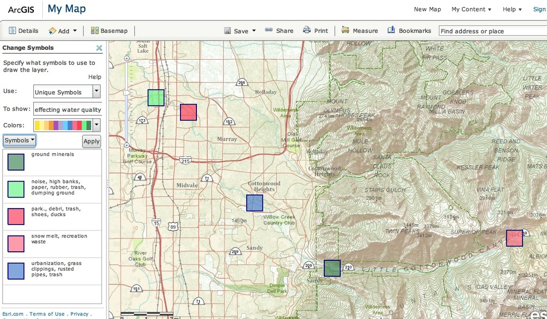
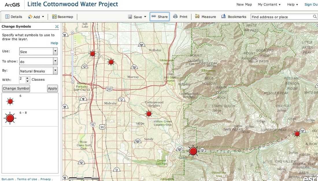
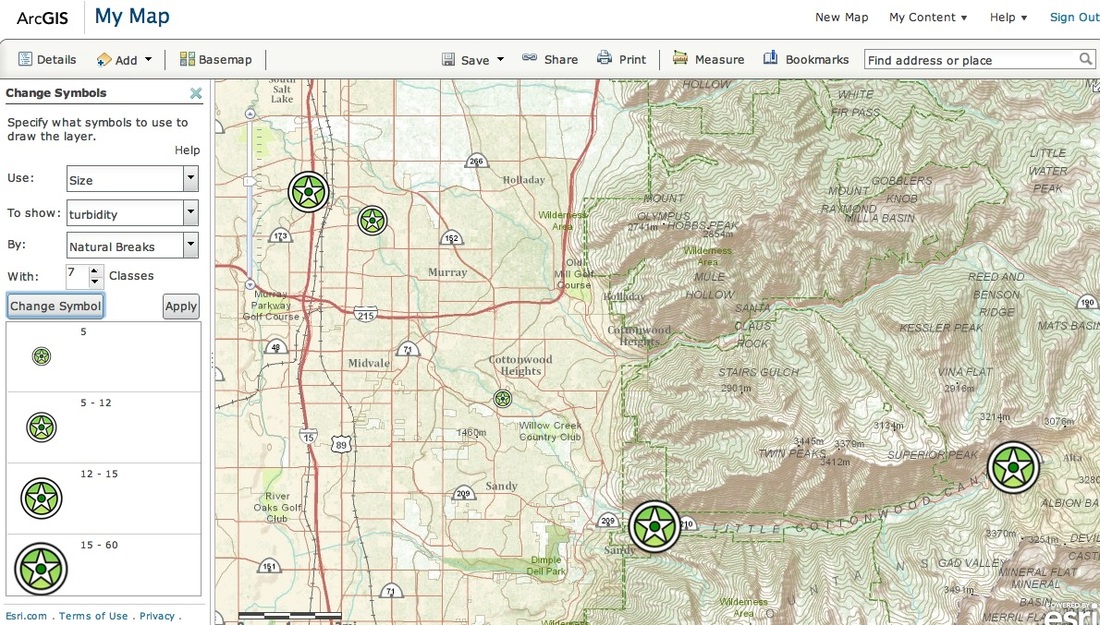
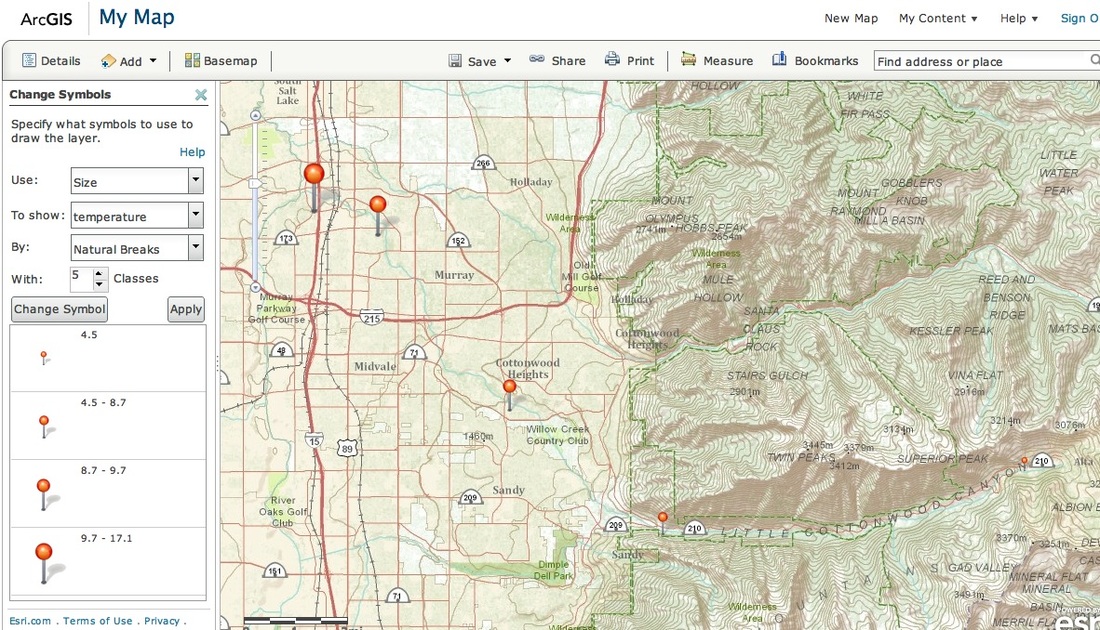
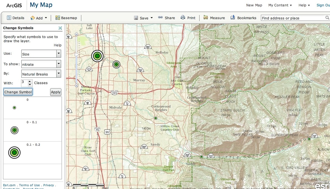
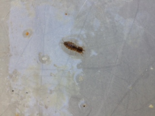
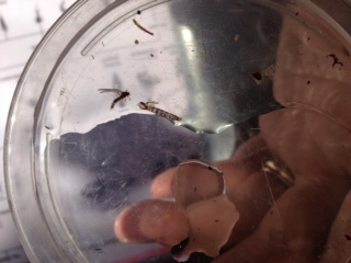
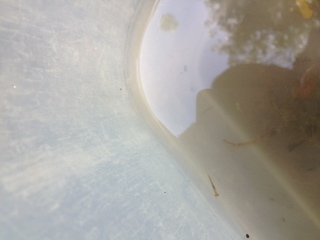
Little Cottonwood Water Quality Fieldtrip
Teachers went from the top of Little Cottonwood Canyon into town by the old Fundome following the stream and testing the water. We brought back the data and created a map of our findings.
Below you will the results of each map. Personally the bugs were the best!!
Below you will the results of each map. Personally the bugs were the best!!
|
|
|
| water_quality_cmap1_copy.csv |
Links to all the websites I joined
http://utahgeo.org
http://gis.utah.gov/
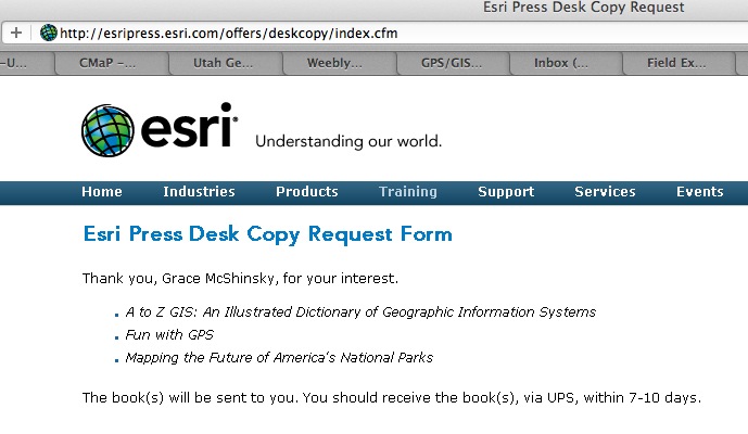
http://esripress.esri.com/offers/deskcopy/index.cfm
http://gis.utah.gov/
http://esripress.esri.com/offers/deskcopy/index.cfm